
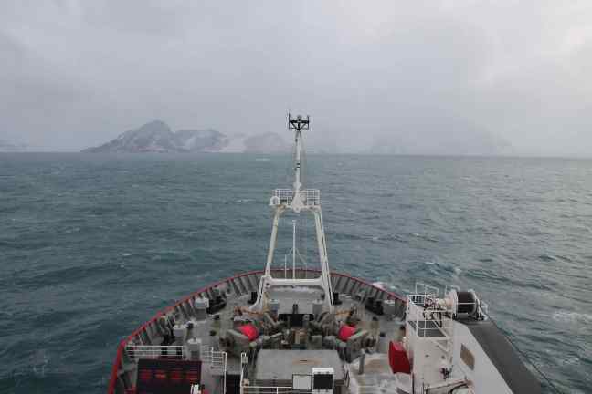
It’s been a while since our last post, so time for an update! We’ve spent the last few days at Signy Island, which is part of the South Orkney Islands archipelago. You can see the location on the map here. We arrived at Signy early on Sunday morning with the intention of heading straight onto the island for some fieldwork. However, it is not possible for the JCR to dock at Signy as it is too shallow around the island and the ship has to stay well away from the coast. The only way to get there is in small rubber powerboats which get lowered over the side of the ship to ferry passengers to the island. So we all got geared up in our boat suits and lifejackets, ready to get in the boats, but unfortunately the weather was not great and the sea was too rough to be able to use the boats safely so the decision was made to postpone the fieldwork.


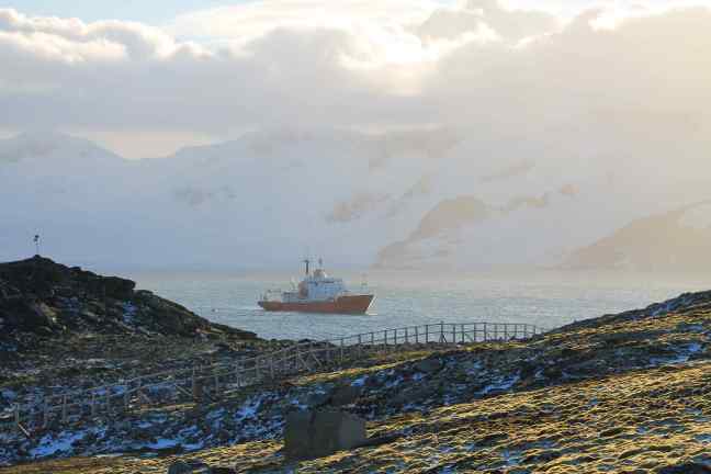
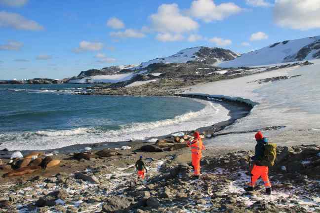
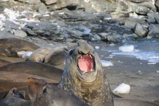
Monday brought much better weather, with lovely sunshine, and the swell had died down enough to use the boats. A field party of six of us set off early in the morning and got dropped off at Signy Island research station. This is one of the smaller BAS bases which is only manned during the summer season, and it had been closed down for winter just a few days before we got there, so there was no one there to welcome us apart from some huge elephant seals who had set up camp on the jetty and all around the base. They looked pretty big and menacing up close, growling and baring their teeth at us as we approached, but they seemed happy enough to let us walk past. The effort required to move their huge bodies probably wasn’t worth losing their spot in the sun!


The objective of the fieldtrip was to collect some ice cores from one of the glaciers on the island and water samples from the melt pools at the foot of the glacier. These cores and samples will then be analysed for salinity (salt content) and d18O (oxygen isotope). This is all part of one of the main scientific objectives of this voyage, which is to set up an automatic oxygen isotope analyser on the JCR. Once this new piece of equipment is up and running it will be able to analyse the sea water wherever the ship sails and automatically measure its d18O content, which can be used to trace the origin of the water (whether it comes from precipitation, sea ice, glacial runoff, etc.). The new machine requires careful calibration, which is why we need to collect samples from various locations such as glaciers, glacial fjords, sea ice, etc. A more detailed post about the science behind all this will follow in due course!
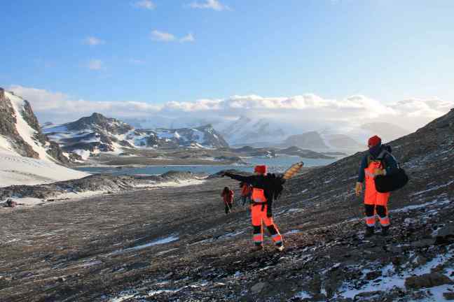
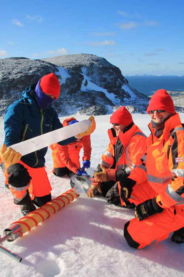
To get our ice cores, we walked up Moraine Valley to Khyber Pass and the McLeod Glacier (there are some great names of features on the map of Signy, including “Shagnasty Island” and “Confusion Island”, someone clearly had fun naming these!). We carried a small handheld ice corer with us, which is basically just a 1-metre long cylinder with a screw thread around the edge and some teeth at the bottom to drill into the ice. Rob, who has over 30 years worth of experience in ice core drilling, showed us all how to use it and we took turns at drilling, which was surprisingly hard work in the tough glacial ice! We got 7 cores in total, in a line from the top of the glacier to the bottom, which was a great success.


After the ice coring we went and got water samples from some of the glacial melt pools and from the foot of the glacier where it meets the ocean. The beach where we were sampling was also covered in elephant seals, and we could smell them long before we could see them! There were some really huge males there, all jostling for space and growling at each other. The noise they make is incredible, a deep guttural growl which is pretty hard to describe! It was quite a spectacle. The female elephant seals are a lot smaller and more peaceful (and a lot prettier!) than the males. There was one female basking in the sun right next to us while we were getting our samples, but she didn’t seem to mind at all and just looked at us quizzically every now and then, before closing her eyes and dozing off again.


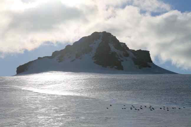
We got picked up again by the boats and ferried back to the JCR, clutching our precious ice cores and water samples, but the day didn’t end there. A second party went out in the boats to collect more water samples from the bay in front of the glacier. Finally, we did a few CTDs to collect yet more samples further out into the bay and at depth. Combining all these various ice cores and water samples will give us a line of data points from the top of the glacier to where it meets the sea, into the bay and out into the open ocean. It was a very long day and we were working well into the evening to finish the CTDs but it was absolutely amazing to be able to visit this beautiful island with such stunning scenery!


We are currently sailing south again, heading towards the sea ice. Hopefully we will find some sea ice that is thick enough to stand on, and then the plan is to get some more ice cores there, which should be pretty cool! We will keep you posted.

Love the welcome party on Singy island!
LikeLike
Just wow! What an amazing exoerience, Erik. It is so interesting to hear some of what it is you’re doing there -great pictures and loving the place names!
LikeLike
Fabulous! What a wonderful day you had on Signy island. Thanks for all the pictures showing the work you did, and providing us with a glimpse of the amazing scenery, not to forget the seals and pinguins.
LikeLike
Erik
Beautifull,
mooie foto’s.
geniet van deze momenten
grtjs Reginald
LikeLike